Eastern Oregon Day Rides

Sagebrush and Gravel In The High Desert

Map - Eastern Oregon Day Rides
Click to open in Google Maps

I’ve visited Oregon many times over the years but, like most people, have stuck to the wet, green 100-mile strip along the Pacific.  The only exception was a weekend jaunt to the Bend/Sisters area nearly a decade ago that gave me a taste of the dramatically different landscape that lies in the high desert east of the Cascade Range.

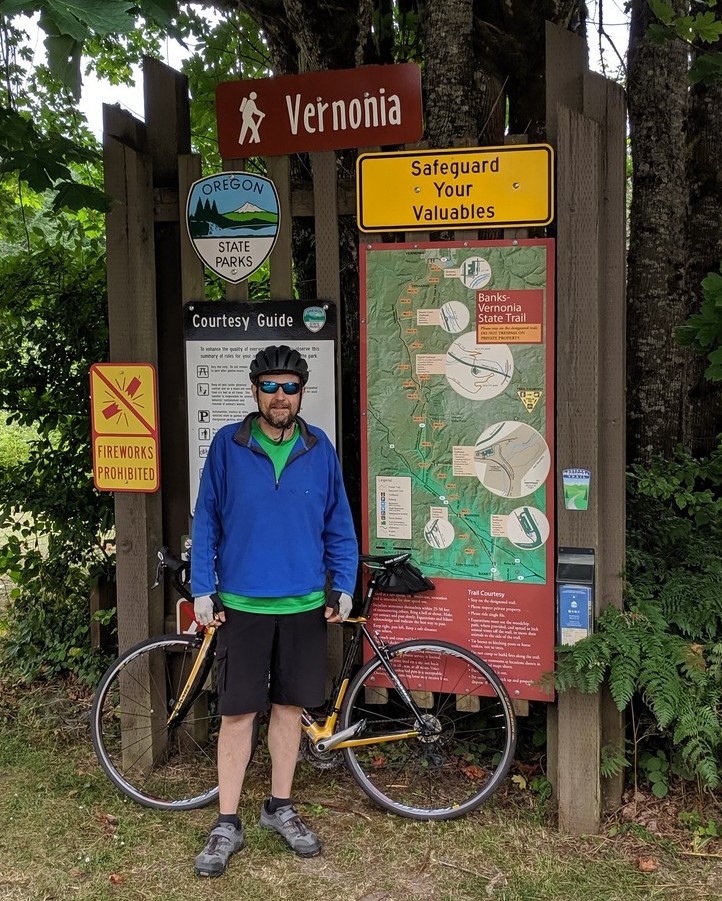
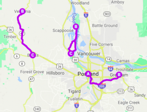
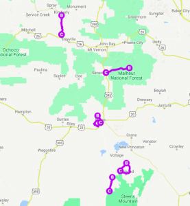
When I returned this year to visit my good friends Steve and Laura in Portland, we agreed it was time to get out and see some of the natural wonders in the east, and to do a lot of it by bike.  The distances are long and our time was limited, so we planned a mix of driving and day rides.  We opted for two nights each in John Day, Burns, and Frenchglen.  I scoured maps and local websites to identify loop or out-and-back rides that would mix great scenery with minimal traffic, moderate distances (25-40 miles), reasonable climbing (2500 feet or less) and decent surfaces (asphalt or well-used gravel).  We decided on five rides:

Feel free to jump ahead to a specific ride:

Continue reading “Eastern Oregon Day Rides”

A Good Workout in the Hills West of Portland

If you’re looking for a day ride that’s a bit more strenuous than the Springwater Corridor or Sauvie Island, but want to avoid the stress of traffic-heavy roads, check out the Banks-Vernonia Rail Trail.  It offers nice towns, great scenery, some elevation changes, and even multiple options for camping.

Official Site:  Oregon State Parks

Difficulty:  Moderate

Ride Type:  Out-and-Back

Surface:  Paved

  ★★★☆☆

!
!

Easy Ride – East Out of Portland

Springwater PathIf you’re looking for a flat, easy, relaxed ride starting downtown or in the southeast quadrant of Portland, the Springwater Corridor is your choice.  It’s a rail trail that starts along the Willamette River near the southern end of the Eastbank Esplanade, heads south to Sellwood, then turns east along Johnson Creek and past Powell Butte to Gresham and Boring.

Most of the trail is off-road and the few road transitions are bike friendly.

Official Site:    City of Portland Parks

Difficulty:  Easy

Ride Type:  Out-and-Back

Surface:  Paved

  ★★★☆☆

Three Rides within 30 miles of Downtown Portland

Portland Day Rides Map
Click to open in Google Maps

Portland is a one of the most bike friendly cities in the US, with bike lanes everywhere, thousands of bike commuters, local bike shops in most neighborhoods, and lots of organized events.  This includes the annual Naked Bike Ride, which flashed through town while I was there in late June and early July.  BikePortland.org has a useful calendar.

I have some great friends who live in the lively Hawthorne neighborhood and are kind enough to let me stay in their basement guest suite during extended summer visits when I can enjoy their company and escape the east coast humidity.  This year, we ventured out for a week-long trip to do some cycling in the high desert of eastern Oregon.  I also took advantage of the opportunity to do some day rides in and around the city.  Each was flexible in length, with options up to 40+ miles and offered great scenery with minimal traffic concerns.

Feel free to jump ahead to a specific ride:

Continue reading “Day Rides Around Portland (OR)”

Bucolic Loop – Just North of Portland

Multnomah Channel

Just 11 miles from downtown Portland, as the waters of the Columbia and Willamette rivers flow from their confluence towards the Pacific Ocean, they encircle a bucolic piece of farm and park land call Sauvie Island.  It’s about a 60 minute ride (or 20 minute drive) from downtown Portland but feels like a world away, with winding country lanes, quaint farms, lakes, beaches, a lighthouse, and wildlife refuge areas.

Official Site:   SauvieIsland.org

Difficulty:  Easy

Ride Type:  Out-and-Back and/or Loop

Surface:  Paved
  ★★★★☆

Continue reading “Sauvie Island (OR)”